

Earth Science Flip Chart Manufacturer,Supplier and Exporter in India
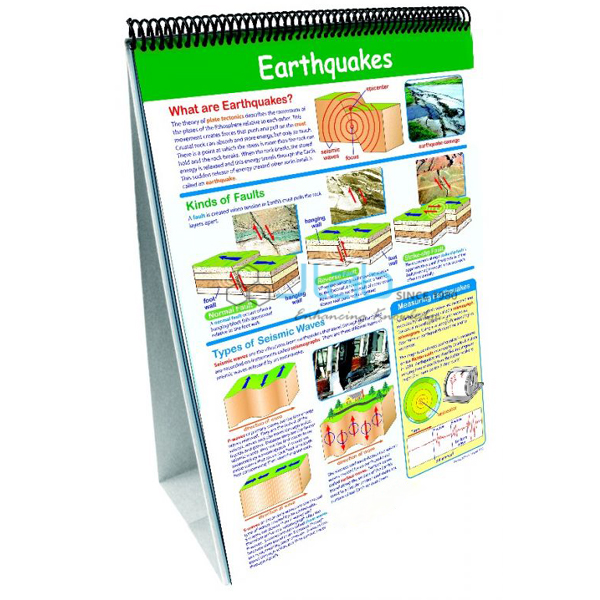
Product Code : EL-SSE-7487
Jlab Export is a leading Earth Science Flip Chart Manufacturer,and suppliers in India
Earth Science Flip Chart (code EL-SSE-7487) is a flipchart set of 10 double-sided, laminated 30 x 45 cm charts used to review earth science with primary and middle-school classes: minerals, rocks, earthquakes, fossils, plate tectonics, geologic time, weathering and soil formation, Earth’s atmosphere, weather and our solar system. JLab (Jain Laboratory Instruments Pvt Ltd) produces this chart set at its works in Ambala, India.
Specifications
| Parameter | Detail |
|---|---|
| Format | Science flipchart set; one set of a 10-set series |
| Topics covered | Minerals; rocks; earthquakes; fossils; plate tectonics; geologic time; weathering of rocks and soil formation; Earth’s atmosphere; understanding weather; our solar system |
| Charts | 10 double-sided, laminated charts |
| Chart size | Full-sized, 30 x 45 cm |
| Also listed with the set | Activity guide with black-line copy-masters; sturdy easel; activity chart with questions, labelling exercises and vocabulary review |
| Level | The series presents a levelled review of grades 1–8 (ages 5–14) science standards |
| Quality check | Each flipchart set is visually inspected before dispatch |
| Pack quantity | Each (one flipchart set, sold individually) |
| Minimum order quantity | 10 units |
| Dispatch time | Usually 7–10 working days |
| Product code | EL-SSE-7487 |
| Brand | JLab |
| Manufacturer | Jain Laboratory Instruments Pvt Ltd (JLab) — OEM |
| Country of origin | India (made in Ambala, Haryana) |
What Is the Earth Science Flip Chart Used For?
The set is a whole-class teaching and revision aid. Standing on its easel at the front of the room, it lets the teacher work through one topic at a time — minerals, rocks and fossils, plate tectonics and earthquakes, geologic time, weathering and soil formation, the atmosphere and weather, and our solar system — while students follow on the large charts. The activity chart’s questions, labelling exercises and vocabulary review help check understanding at the end of a topic, and the black-line copy-masters in the activity guide are pages meant to be photocopied as student worksheets.
Because the series is pitched at grades 1–8 (ages 5–14), it suits primary and middle-school science, including the earth science topics of class 6–8 science and geography, and it pairs well with hands-on material in a school geography lab, such as rock and mineral specimens or a seismograph model. Keep the charts on the easel or stored flat, away from damp and direct sunlight, and wipe the laminated surface with a soft, dry cloth.
What to Specify When Ordering
- Quantity — the minimum order is 10 sets; schools often plan one set per science or geography classroom.
- Other flipcharts — if you also need the Human Body Flip Chart, list it in the same enquiry and ask which other sets of the series can be quoted.
- Contents check — ask JLab to confirm the current contents of the set (charts, activity guide and easel) with your quotation.
- Hands-on companions — rock and mineral specimens, earth models and a seismograph model can go on the same order.
Frequently Asked Questions
What topics does the Earth Science Flip Chart cover?
It covers minerals, rocks, earthquakes, fossils, plate tectonics, geologic time, weathering of rocks and soil formation, Earth’s atmosphere, understanding weather, and our solar system.
How many charts are in the set, and how big are they?
There are 10 double-sided, laminated charts. They are listed as full-sized charts measuring 30 x 45 cm.
Which age group is it designed for?
Primary and middle school. The flipchart series is presented as a levelled review of grades 1–8 (ages 5–14) science standards, so it can be used both for first teaching and for revision in those years.
Are an easel and activity guide included?
The listing names an activity guide with black-line copy-masters, a sturdy easel and an activity chart with questions, labelling exercises and vocabulary review as features of the set. Ask JLab to confirm the contents with your quotation.
What does JLab need for an export quotation?
The number of sets, the destination country and port or city, the delivery terms you prefer (for example FOB or CIF), any packing or labelling instructions, and a tender reference if you are buying against a tender.
Who makes the Earth Science Flip Chart?
Jain Laboratory Instruments Pvt Ltd (JLab) makes this flipchart set in Ambala, Haryana, and quotes for it directly, so it can be ordered together with JLab’s other laboratory equipment.
OEM Manufacturer
JLab is the trading name of Jain Laboratory Instruments Pvt Ltd, a school and laboratory equipment company incorporated in 2017 and based on Hargolal Road, Ambala, Haryana. JLab prints this flipchart set in Ambala as part of its own geography and science range, so schools, dealers and importers can put charts, rock specimens and models on one quotation and one shipment. Each set is visually inspected before dispatch, and repeat orders are handled by the same team. JLab exports worldwide and ships to buyers in every region — for example the Philippines in Southeast Asia, Bhutan in South Asia, El Salvador in Central America and the Caribbean, Algeria in North Africa and Hong Kong in East Asia. Schools buying through a tender can find details on the JLab lab tenders page.
Related Earth Science Teaching Aids
- Human Body Flip Chart — a JLab flipchart set in the same chart format, covering human body systems such as bones, muscles and skin, circulation and digestion.
- Introductory Earth Science Collection — number-coded rock and mineral specimens with a streak plate, magnet and magnifier, for hands-on work on the minerals and rocks topics.
- Seismograph Model For Earth Science Lab — shows how the intensity of earthquakes is measured.
- Earth Model 7 Parts For Earth Science Lab — a sectional model of the Earth’s interior with detachable, colour-coded layers, useful alongside the plate tectonics topic.
- Landforms Model For Earth Science Lab — models of landform features on glaciers, coastlines, canyons, deserts, lakes and mountains, linked to the weathering topic.
Browse more in Science Skills Equipment or the full Geography Lab Models range.
Request a Quote
Quotes come direct from JLab. Use the Add To Cart enquiry button on this page, or send the number of sets (minimum 10), any other flipcharts, specimens or models you want on the same order, and your delivery location through the contact page.
Last updated: 25 October 2026