
Geographical 3D Model Manufacturer,Supplier and Exporter in India
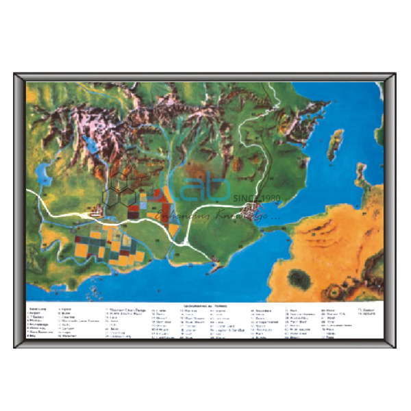
Product Code : EL-AM-6102
Jlab Export is a leading Geographical 3D Model Manufacturer,and suppliers in India
Geographical 3D Model (code EL-AM-6102) is a framed three-dimensional geography teaching model, offered in a choice of physical-geography and environment topics, from rocks and volcanoes to glacial landscapes and the oxygen and carbon cycle. It is made by Jain Laboratory Instruments Pvt Ltd (JLab) at its works in Ambala, India.
Specifications
| Parameter | Detail |
|---|---|
| Type | Three-dimensional (3D) geography teaching model |
| Topics available | Geographical terms; River in action (water cycle); Rocks and volcanoes; Conventional signs; Air and water pollution; The volcanic system; Oxygen and carbon cycle in nature; Model of restless earth; Formation of rocks; Glacial landscape; Origin of the earth; Earthquake; Folds and faults; The Earth’s layers |
| Surface | Washable |
| Backing and frame | Hard backing with aluminium frame |
| Mounting | Hanging hooks |
| Customisation | Made in various customised options to the customer’s requirements |
| Quality check | Each model is visually inspected before dispatch |
| Pack quantity | Each (sold individually) |
| Minimum order quantity | 10 units |
| Dispatch time | Usually 7–10 working days |
| Product code | EL-AM-6102 |
| Manufacturer | Jain Laboratory Instruments Pvt Ltd (JLab) — OEM |
| Country of origin | India (made in Ambala, Haryana) |
What Is the Geographical 3D Model Used For?
It is geography lab equipment for lessons on how the Earth’s surface takes shape and how its natural cycles work. Each model shows one topic, so a school can build up a set for its geography room topic by topic, and the conventional-signs model supports map-reading work as well as physical geography.
What to Specify When Ordering
- Topic — name each topic you need from the list above, for example “Glacial landscape” or “River in action (water cycle)”.
- Quantity — give the number of models for each topic.
- Single-topic models — the separate earth-science 3D models linked below can be quoted on the same enquiry.
Frequently Asked Questions
Which topics can the Geographical 3D Model show?
The topics offered are geographical terms, river in action (the water cycle), rocks and volcanoes, conventional signs, air and water pollution, the volcanic system, the oxygen and carbon cycle in nature, the restless earth, formation of rocks, glacial landscape, origin of the earth, earthquake, folds and faults, and the Earth’s layers.
Can the model be customised?
Yes. JLab makes these models in various customised options to suit the customer’s requirements, so describe what you need when you ask for a quotation.
How does it differ from the Geographical Terms 3D Model?
Both have a washable surface, a hard backing, an aluminium frame and hooks. The Geographical Terms 3D Model covers a single subject — ideal landscape features that show how geographical terms are formed — while the Geographical 3D Model is ordered by topic from the wider list.
Why use a 3D model instead of a wall chart?
Relief is easier to understand when students can see it. A raised surface shows the rise and fall of the land and the form of features such as volcanoes or glaciated valleys, which a printed chart can only suggest with shading or contours.
What should an export enquiry include?
The topics and quantities, the destination country and port or city, the delivery terms you prefer (for example FOB or CIF), any packing or labelling instructions, and the tender reference if one applies.
Who manufactures the Geographical 3D Model?
Jain Laboratory Instruments Pvt Ltd (JLab) makes it at its own works in Ambala, Haryana, India.
OEM Manufacturer
JLab is the trading name of Jain Laboratory Instruments Pvt Ltd, an Indian manufacturer of teaching models and laboratory equipment for geography, science and biology, incorporated in 2017 and based on Hargolal Road, Ambala, Haryana. The geographical models are produced in JLab’s own works instead of being sourced from a trader, which lets schools, colleges, dealers and importers buy factory-direct and place repeat orders with the maker itself. JLab exports worldwide and ships to buyers in every region — for example Lithuania in Northern Europe, Zambia in East Africa, Niger in West Africa, the Maldives in South Asia and Argentina in South America. For institutional purchases, see the JLab lab tenders page.
Single-Topic Earth Science 3D Models
- Geographical Terms 3D Model — ideal landscape features that show how geographical terms are formed, in rigid PVC with a markable, washable surface.
- 3D Model of Restless Earth — plate tectonics: sea-floor spreading, subduction zones, the continents and the mid-ocean ridge.
- Origin of Earth 3D Model — how the planet formed and changed in its earliest stages.
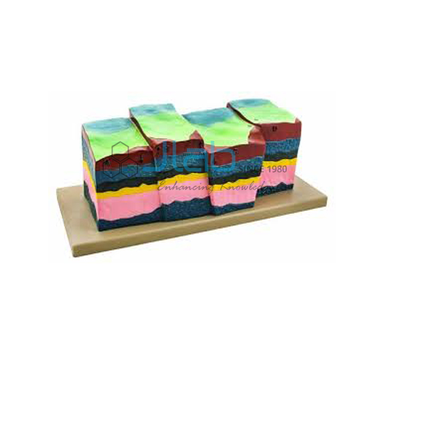
- Deformation of The Earth Folds and Fault 3D Model — how the Earth’s crust is folded and faulted.
This model is listed in the Anatomical Models category of the anatomical models range; the single-topic earth models are in Educational Rock and Minerals.
Request a Quote
To get a quotation, press Add To Cart on this page or write through the contact page, listing the topics, the number of models of each and the delivery address.
Last updated: 22 October 2026