Collecting River System Model Manufacturer,Supplier and Exporter in India

Product Code : EL-ERAM-4400
Jlab Export is a leading Collecting River System Model Manufacturer,and suppliers in India
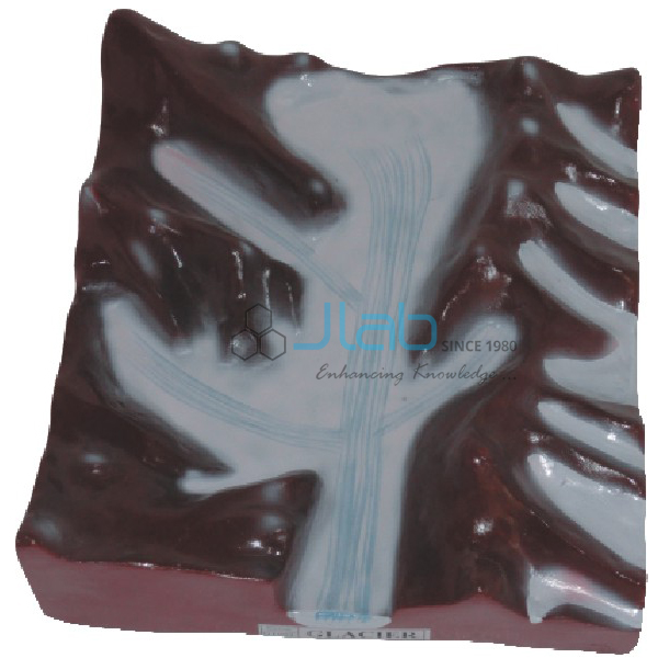
Collecting River System Model (code EL-ERAM-4400) is a geography teaching model of the upper part of a river system, where a network of tributaries gathers water in the headwater region. It helps students link the headwaters to the landforms associated with them — V-shaped valleys, interlocking spurs, rapids, waterfalls and gorges. It is made by Jain Laboratory Instruments Pvt Ltd (JLab) at its works in Ambala, India.
Specifications
| Parameter | Detail |
|---|---|
| Topic | Collecting river system — a network of tributaries in the headwater region |
| Associated landforms (as listed) | V-shaped valleys, interlocking spurs, rapids, waterfalls and gorges |
| Quality check | Each model is visually inspected before dispatch |
| Pack quantity | Each (sold individually) |
| Minimum order quantity | 10 units |
| Dispatch time | Usually 7–10 working days |
| Product code | EL-ERAM-4400 |
| Manufacturer | Jain Laboratory Instruments Pvt Ltd (JLab) — OEM |
| Country of origin | India (made in Ambala, Haryana) |
What Is the Collecting River System Model Used For?
Physical geography often divides a river into three working parts: a collecting system in the headwaters, a transporting system along the main trunk stream, and a dispersing system near the mouth. This model covers the first part. In the headwaters, small streams flow down steep slopes and cut downward, so their valleys take a V shape; the young stream winds between interlocking spurs, and where it crosses bands of resistant rock it forms rapids and waterfalls, while deep, narrow, steep-sided gorges show where downcutting has been strongest.
Teachers use it in lessons on the work of rivers, such as the CBSE class 7 and class 11 landform chapters, and as geography lab equipment in colleges. Beside the transporting and delta models it lets students trace water and sediment from source to sea.
Frequently Asked Questions
What is a collecting river system?
It is the headwater part of a river system, made up of a network of tributaries that gather rainfall and runoff and feed it into the main stream.
Which landforms does the model relate to?
The listing names V-shaped valleys, interlocking spurs, rapids, waterfalls and gorges as the features associated with the collecting system. Ask JLab which of them are modelled and labelled on the current version.
How is it different from the Transporting River System Model?
This model deals with the headwater network of tributaries. The transporting model covers the main trunk stream that carries water and sediment towards the dispersing system, with meanders, oxbow lakes and levees.
OEM Manufacturer
JLab is the trading name of Jain Laboratory Instruments Pvt Ltd, an Indian manufacturer of geography and earth science models and school laboratory equipment, incorporated in 2017 on Hargolal Road, Ambala, Haryana. The model is produced in JLab’s own works, so schools, colleges, dealers and importers buy direct from the maker. The company is registered for tax as GSTIN 06AADCJ9848D1ZE and holds Legal Entity Identifier 549300DTGS77DGYD6N03. JLab exports worldwide and ships to buyers in every region — for example Poland in Eastern Europe, Zambia in East Africa, Trinidad and Tobago in Central America and the Caribbean, Uzbekistan in Central Asia and Austria in Western Europe.
Related River Landform Models
- Transporting River System Model — the next stage: the main trunk stream with meanders, oxbow lakes and levees.
- Gorge and A Mountain Model — a closer look at a deep ravine carved by a river.
- Valley Model — an elongated lowland with a river running along the bottom.
- Delta Model — the landform built from sediment at the river mouth.
Browse Educational Rock and Minerals or the full Rocks and Minerals range.
Request a Quote
Quotes come direct from the manufacturer. Use the Add To Cart enquiry button, or send the quantity (minimum 10 units), destination and any labelling or language needs through the contact page.
Last updated: 9 October 2026