
Topographic Modeling and Mapping Activity Model Manufacturer,Supplier and Exporter in India

Product Code : EL-ME-7484
Jlab Export is a leading Topographic Modeling and Mapping Activity Model Manufacturer,and suppliers in India
Topographic Modeling and Mapping Activity Model (code EL-ME-7484) is a classroom activity model for learning how the shape of the land is modelled and shown on a topographic map. It includes an illustrated teacher’s and student’s guide with easy-to-follow instructions, so the activity can be run in school geography lessons and in college and university map-work classes. It is made by Jain Laboratory Instruments Pvt Ltd (JLab) at its works in Ambala, India.
Specifications
| Parameter | Detail |
|---|---|
| Type | Topographic modelling and mapping activity model |
| Guide | Illustrated teacher’s and student’s guide with easy-to-follow instructions |
| Quality check | Each model is visually inspected before dispatch |
| Pack quantity | Each (sold individually) |
| Minimum order quantity | 10 units |
| Dispatch time | Usually 7–10 working days |
| Product code | EL-ME-7484 |
| Manufacturer | Jain Laboratory Instruments Pvt Ltd (JLab) — OEM |
| Country of origin | India (made in Ambala, Haryana) |
What Is the Topographic Modeling Activity Used For?
A topographic map squeezes hills, valleys and slopes onto flat paper using contour lines, which join points of equal height. Many students find contours abstract until they connect a real three-dimensional shape with its map. Topographic modelling and mapping activities are designed to make that connection, and through them students learn how contour spacing shows the slope (close lines for steep ground, wide spacing for gentle ground), how a hill, a valley or a ridge looks in plan, and how a cross-section is drawn from a map. These skills are part of map work in school geography and of the topographical maps chapter in class 11 practical geography, and they underpin fieldwork and surveying in college courses.
The illustrated teacher’s and student’s guide sets out the activity with easy-to-follow instructions for both.
What to Specify When Ordering
- Quantity — the minimum order is 10 units; decide whether students will work individually or in groups.
- Contents list — ask for the full list of parts and the dimensions, which the listing does not give.
- Map-work companions — contour charts, relief models and compasses (linked below) can be added to the same enquiry.
Frequently Asked Questions
What is included with the Topographic Modeling and Mapping Activity Model?
The listing states an illustrated teacher’s and student’s guide with easy-to-follow instructions. Ask JLab for the full contents list before ordering.
What does the activity teach?
It is a topographic modelling and mapping activity, so it centres on how landforms are represented on topographic maps — contour lines, the link between contour spacing and slope, and reading landform shapes from a map. The listing does not detail the individual exercises; the included guide sets them out.
Which level is it suited to?
Map work in school geography, the topographical maps chapter of class 11 practical geography, and introductory map and fieldwork classes at college and university.
Who manufactures it?
Jain Laboratory Instruments Pvt Ltd (JLab) at its works in Ambala, Haryana, India.
OEM Manufacturer
JLab is the trading name of Jain Laboratory Instruments Pvt Ltd, an Indian manufacturer of geography and science teaching equipment, incorporated in 2017 with its base on Hargolal Road, Ambala, Haryana. This activity model comes from JLab’s own works, not from a trader, so schools, colleges, dealers and importers buy it factory-direct; units are visually inspected before dispatch, and repeat orders are handled by the manufacturer. JLab is registered for GST under GSTIN 06AADCJ9848D1ZE and holds Legal Entity Identifier 549300DTGS77DGYD6N03. It exports worldwide and ships to every region — for example the Maldives in South Asia, Greece in Southern Europe, Myanmar in Southeast Asia, Bahrain in the Middle East and Mongolia in East Asia. Tender buyers can refer to the JLab lab tenders page.
Map-Work and Relief Teaching Aids
- Hill Features, Contours and Map Setting Chart — a laminated chart in English and Hindi combined.
- Terrain Model — colour landform models with overlays that lift off for comparison.
- 3D Relief Models- I — relief wall models in rigid PVC with a markable, washable surface.
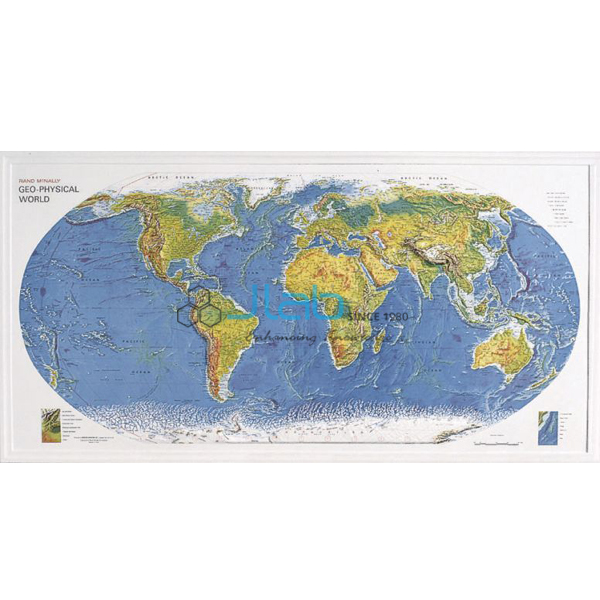
- Geo Physical World Map — a 3-D raised relief map of the world’s physical features.
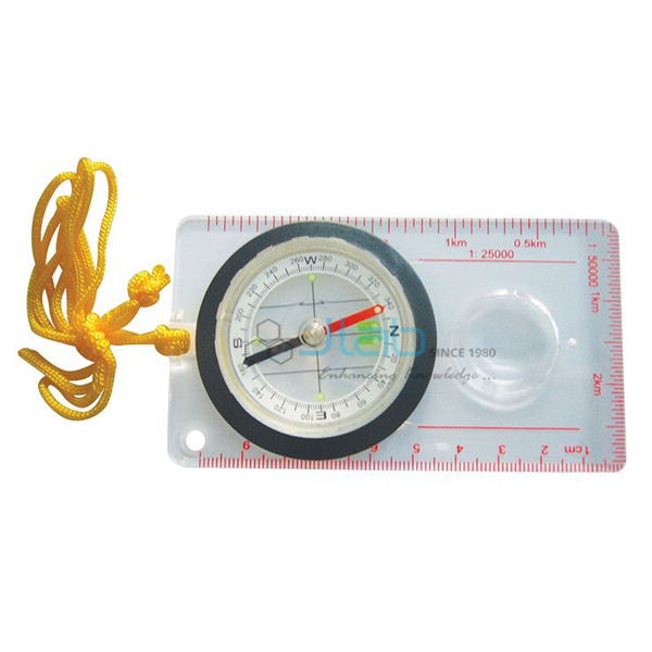
- Orienteering Compass — a base-plate compass for taking map work into the field.
See the full Mapping Equipment range or all Geography Lab Models.
Request a Quote
Quotes come direct from the manufacturer. Use the Add To Cart enquiry button on this page, or send the quantity (minimum 10 units), your destination country and port or city, delivery terms such as FOB or CIF, and any tender reference through the contact page.
Last updated: 3 October 2026