
Assam and N.E. States Chart Manufacturer,Supplier and Exporter in India
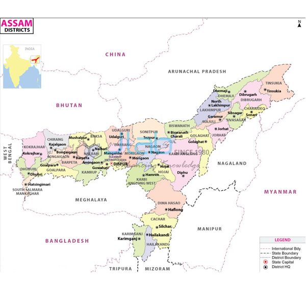
Product Code : EL-SMP-3306
Jlab Export is a leading Assam and N.E. States Chart Manufacturer,and suppliers in India
Assam and N.E. States Chart (code EL-SMP-3306) is a 70 x 100 cm political wall map of Assam and the north-eastern states of India, showing the latest boundaries, capital cities and important towns. It is printed in multicolour on 80 gsm map litho paper, laminated on both sides with hot-seal polyester film and fitted with plastic rollers for hanging. JLab — Jain Laboratory Instruments Pvt Ltd — makes it at its works in Ambala, India.
Specifications
| Parameter | Detail |
|---|---|
| Coverage | Assam and the north-eastern states (political map) |
| Shown on the map | Latest boundaries; capital cities and important towns; political features |
| Size | 70 x 100 cm |
| Printing | Multicolour, on 80 gsm map litho paper |
| Lamination | Hot-seal polyester film on both sides |
| Rollers | Plastic rollers at top and bottom |
| Language | English |
| Quality check | Each chart is visually inspected before dispatch |
| Pack quantity | Each (sold individually) |
| Minimum order quantity | 10 units |
| Dispatch time | Usually 7–10 working days |
| Product code | EL-SMP-3306 |
| Manufacturer | Jain Laboratory Instruments Pvt Ltd (JLab) — OEM |
| Country of origin | India (made in Ambala, Haryana) |
What Is the Assam and North-East Map Used For?
The north-east is joined to the rest of India only by the narrow Siliguri Corridor in northern West Bengal, and it shares international borders with Bhutan, China, Myanmar and Bangladesh — relationships that pupils grasp far more quickly on a wall map than from a list. With a political map of the region, a class can find Assam and its capital Dispur, which lies within the city of Guwahati; trace the boundaries of the other six states that, with Assam, make up the Seven Sisters, with capitals at Itanagar, Kohima, Imphal, Aizawl, Agartala and Shillong; and locate Assamese towns such as Dibrugarh, Jorhat, Silchar and Tezpur. These places are given as lesson examples: the listing does not itemise the towns marked, or say whether Sikkim, which is also part of the official North Eastern Region, is included, so check with JLab if your syllabus needs a particular place.
Schools in the north-east use the chart for home-state and regional lessons in social science; elsewhere it supports the study of India’s states in geography rooms, and it is a convenient reference for map-based general-knowledge practice. The double-sided lamination lets the surface be wiped clean with a damp cloth. Point to places with a pointer rather than pins, which would pierce the film, and roll the map from the bottom roller when it is put away.
What to Specify When Ordering
- Quantity — the minimum order is 10 charts.
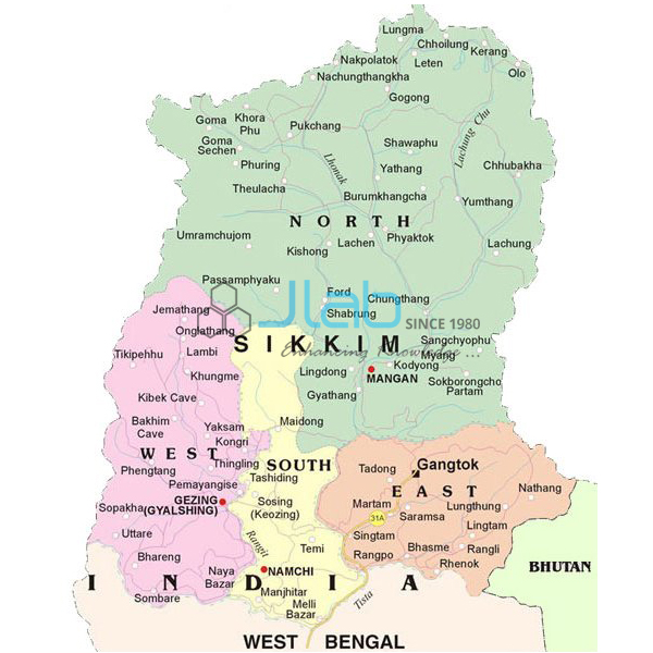
- Neighbouring maps — the Sikkim and West Bengal charts complete the eastern part of the country.
- Wider context — an Asia political chart or a political globe shows the countries along the north-east’s borders.
- Delivery and tender details — delivery town or export port, FOB or CIF terms, and the tender reference if there is one.
Frequently Asked Questions
Which states does this chart cover?
Assam and the north-eastern states, with their latest boundaries, capital cities and important towns. The listing does not name each state; if you need to know whether Sikkim is shown, ask JLab before ordering.
What is the chart made of, and how large is it?
It is 70 x 100 cm, printed in multicolour on 80 gsm map litho paper, laminated on both faces with hot-seal polyester film, and finished with plastic rollers at the top and bottom.
Which language is it printed in?
English. If you need another language, ask JLab when you send your enquiry rather than assuming one is available.
Does the map show the Brahmaputra and the hill ranges?
It is a political map, listed with boundaries, capitals, towns and political features. Rivers and relief are not part of the listed content, so confirm with JLab if your lesson needs them.
How should a laminated wall map be looked after?
Hang it by the top roller away from damp walls, wipe it with a slightly damp cloth, avoid pins and sticky tape on the surface, and roll it up from the bottom when not in use.
Who manufactures this chart?
Jain Laboratory Instruments Pvt Ltd (JLab) makes it at its works in Ambala, Haryana, and supplies it directly.
OEM Manufacturer
JLab is the trading name of Jain Laboratory Instruments Pvt Ltd, a manufacturer in India of wall maps, teaching charts and school laboratory equipment, incorporated in 2017 and based on Hargolal Road, Ambala, Haryana. The map is produced in JLab’s own works rather than bought from a trader, so schools, colleges, dealers and importers buy it direct from the maker, each copy is inspected by eye before it ships, and further orders are handled by the same manufacturer. JLab exports worldwide and supplies buyers in every region — among them the USA in North America, Argentina in South America, Georgia in Eastern Europe, Malaysia in Southeast Asia and the Maldives in South Asia. Institutions buying by tender can refer to the JLab lab tenders page.
Related Political Maps
- Sikkim Chart — a laminated 70 x 100 cm chart in English only or the regional language only.
- West Bengal Political Map Chart — the state through which the north-east connects to the rest of India.
- Political Chart — a laminated 70 x 100 cm political chart in English only or Hindi only.
- Asia Political Chart — the neighbouring countries on a laminated chart in English only or Hindi only.
- Political Globe — a globe showing the political boundaries of the world’s countries.
Other state maps are in the State Maps Political range, part of the full Charts catalogue.
Request a Quote
Quotations come directly from the manufacturer. Use the Add To Cart button on this page or the contact page, giving the number of maps (minimum 10 units), any other state or world maps you want, and the delivery address or port.
Last updated: 3 October 2026