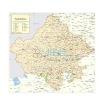

State Maps Political Manufacturer, Suppliers and Exporter in India
Jlabexport is a leading State Maps Political Manufacturer,and suppliers in India, United States, Indonesia, Brazil, Bangladesh, Mexico, Japan, Egypt, Philippines, Democratic Republic of the Congo, Vietnam, Iran, Turkey, Tanzania, United Kingdom, France, South Africa, Italy, Kenya, Colombia, Sudan, Uganda, South Korea, Argentina, Afghanistan, Yemen, Angola, Morocco, Poland, Uzbekistan, Mozambique, Malaysia, Ghana, Saudi Arabia, Peru, Madagascar, Côte d’Ivoire, Cameroon, Niger, Venezuela, Australia, Syria, Mali, Burkina Faso, Sri Lanka, Malawi, Zambia, Chad, Kazakhstan, Somalia, Chile, Senegal, Ecuador, Cambodia, Zimbabwe, Guinea, Benin, Rwanda, Burundi, Bolivia, South Sudan, Tunisia, Haiti, Belgium, Dominican Republic, Jordan, United Arab Emirates, Honduras, Tajikistan, Papua New Guinea, Portugal, Togo, Sierra Leone, Belarus, Laos, Turkmenistan, Libya, Kyrgyzstan, Nicaragua, Paraguay, Bulgaria, Serbia, Republic of the Congo, Lebanon, Liberia, Central African Republic, Palestine, Oman, Mauritania, New Zealand, Costa Rica, Kuwait, Panama, Croatia, Georgia, Eritrea, Mongolia, Uruguay, Qatar, Namibia, Bosnia and Herzegovina, Moldova, Armenia, Gambia, Jamaica, Lithuania, Albania, Gabon, Botswana, Lesotho, Guinea-Bissau, Slovenia, Equatorial Guinea, Latvia, North Macedonia, Bahrain, Trinidad and Tobago, Timor-Leste, Cyprus, Estonia, Eswatini, Mauritius, Djibouti, Fiji, Comoros, Solomon Islands, Guyana, Bhutan, Luxembourg, Suriname, Montenegro, Malta, Maldives, Cabo Verde, Brunei, Belize, Bahamas, Iceland, Vanuatu, Barbados, São Tomé and Príncipe, Samoa, Saint Lucia, Kiribati, Seychelles, Grenada, Saint Vincent and the Grenadines, Antigua and Barbuda. Jlab is renowned Exporter and Manufacturer of State Maps Political, State Maps Political Suppliers, State Maps Political Manufacturer throughout the world to be used in Schools, College and Universities


Andhra Pradesh Political Chart
Product Code : EL-SMP-3307
Political wall map of Andhra Pradesh showing capital cities and important towns. Size 70 x 100 cm, laminated on both sides, in English.
View Details


Karnataka Political Map Chart
Product Code : EL-SMP-3313
Political wall map of Karnataka showing the latest boundaries, capital cities and important towns. Size 70 x 100 cm, laminated on both sides.
View Details
Kerala Political Map Chart
Product Code : EL-SMP-3314
Political wall map of Kerala showing the latest boundaries, capital cities and important towns. Size 70 x 100 cm, laminated on both sides.
View Details