
Punjab Political Map Chart Manufacturer,Supplier and Exporter in India
Product Code : EL-SMP-3315
Jlab Export is a leading Punjab Political Map Chart Manufacturer,and suppliers in India
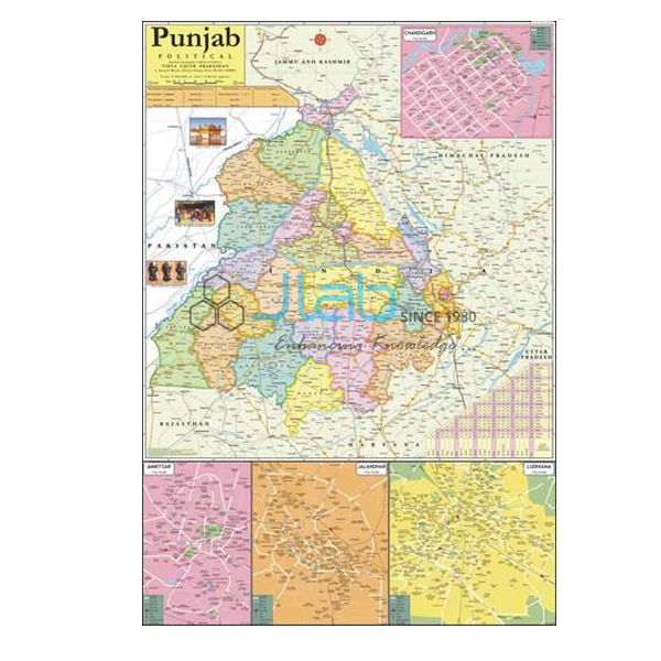
Punjab Political Map Chart (code EL-SMP-3315) is a 70 x 100 cm wall map of Punjab used to teach the state’s latest boundaries, its capital and its important towns in school geography and social studies. Printed in multicolour on 80 gsm map litho paper, it is laminated on both sides with hot-seal polyester film and hangs from plastic rollers. JLab (Jain Laboratory Instruments Pvt Ltd, Ambala, India) supplies it to schools, colleges and dealers.
Specifications
| Parameter | Detail |
|---|---|
| Map | Political map of Punjab state |
| Shows | Latest boundaries, capital cities and important towns, political features |
| Size | 70 x 100 cm |
| Printing | Multicolour print on 80 gsm map litho paper |
| Lamination | Hot-seal polyester film on both sides |
| Rollers | Plastic rollers at top and bottom |
| Language | State language or English only — name your choice in the enquiry |
| Quality check | Each chart is visually inspected before dispatch |
| Pack quantity | Each (sold individually) |
| Minimum order quantity | 10 units |
| Dispatch time | Usually 7–10 working days |
| Product code | EL-SMP-3315 |
| Supplied by | Jain Laboratory Instruments Pvt Ltd (JLab), Ambala, India |
What Is the Punjab Political Map Used For?
A political map shows how a region is divided and where its towns and seats of government lie, rather than its relief. Teachers hang this chart when pupils study their own state: marking Chandigarh, the capital (a union territory that is also the capital of Haryana), finding important towns such as Amritsar, Ludhiana, Jalandhar, Patiala and Bathinda, and tracing Punjab’s international border with Pakistan to the west and its boundaries with Jammu and Kashmir, Himachal Pradesh, Haryana and Rajasthan. The rivers Sutlej, Beas and Ravi give a good starting point for explaining the state’s name, the “land of the five waters”. These are lesson examples; the listing does not name every town, so ask JLab before ordering if a particular place must appear.
The chart also suits a geography lab wall display, map-reading revision before tests and the general-knowledge corner of a library or coaching centre. The polyester film on both faces protects the paper from tearing and moisture and can be wiped with a damp cloth. Hang it by the top roller at a height pupils can reach, and when it is not on display, roll it up from the bottom roller rather than folding it, so the lamination does not crease.
What to Specify When Ordering
- Language — the state’s own language or English only; say which edition you need.
- Quantity — the minimum order is 10 units, supplied as individual charts.
- Other maps — neighbouring-state maps, an India map or a political chart can go on the same enquiry.
- Delivery — your town or, for export, the destination country, port and delivery terms.
Frequently Asked Questions
What does the Punjab Political Map Chart show?
The state’s latest boundaries, capital cities and important towns, and its political features, in multicolour. As a political map, it does not focus on relief or physical detail.
What size is the chart and how is it finished?
It measures 70 x 100 cm, printed on 80 gsm map litho paper, laminated on both sides with hot-seal polyester film and fitted with plastic rollers at the top and bottom.
Can I order it in Punjabi?
The listing offers the state’s own language or English only. Punjabi, written in the Gurmukhi script, is the official language of Punjab, so ask JLab to confirm the language and script of the state-language edition in your quotation.
Which towns are marked on the map?
The listing mentions capital cities and important towns without naming each one. If a lesson depends on a particular town or district, ask JLab before you order.
How should the chart be cleaned and stored?
Wipe the laminated surface with a soft, slightly damp cloth and let it dry. Keep the map rolled on its rollers, away from direct sun and heat, and avoid folding it.
Who supplies this map chart?
JLab — Jain Laboratory Instruments Pvt Ltd of Ambala, Haryana, India — supplies it and handles quotations directly.
Supplier
JLab is the trading name of Jain Laboratory Instruments Pvt Ltd, a supplier of school laboratory equipment and classroom teaching aids, incorporated in 2017 and based on Hargolal Road, Ambala, Haryana. Alongside its own equipment range, JLab resells printed state and country maps like this one, so schools and dealers in Punjab and beyond can order maps and lab items through one supplier; each chart is inspected visually before dispatch. JLab exports worldwide and ships to buyers in every region — Colombia in South America, Turkmenistan in Central Asia, the USA in North America, Niger in West Africa and Hong Kong in East Asia are examples. Tender details are on the JLab lab tenders page.
Maps of Neighbouring States and Beyond
- Haryana Map Chart — the south-eastern neighbour, a 70 x 100 cm political wall map.
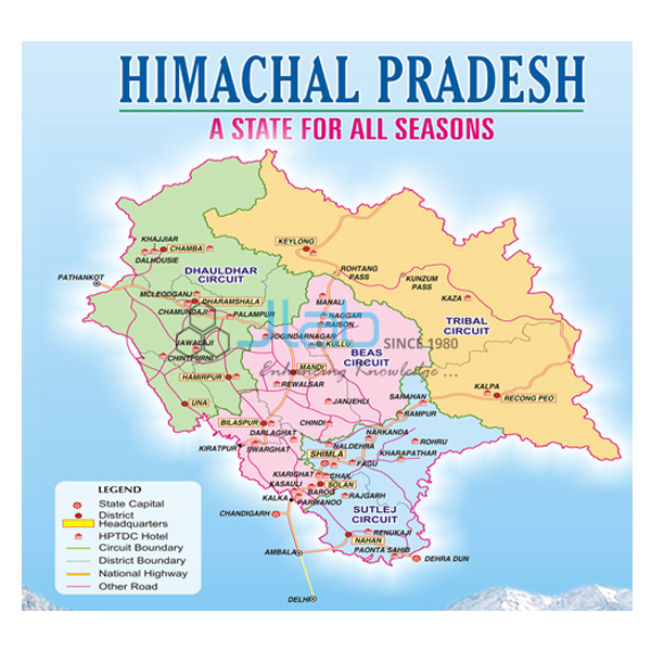
- Himachal Pradesh Map Chart — the hill state to the north-east, in English or Hindi.
- Rajasthan Political Map Chart — the south-western neighbour, also 70 x 100 cm.
- India Chart — a laminated 70 x 100 cm wall map of India in English only or Hindi only.
- Political Chart — a laminated 70 x 100 cm political map chart.
- Map Of World Political — a giant-size laminated world political map in English.
Browse State Maps Political for every state, or all Charts.
Request a Quote
Quotes come directly from JLab. Use the Add To Cart button on this page or the contact page, and give the quantity (minimum 10 units), the language edition, any other maps you need and the delivery location.
Last updated: 4 October 2026