
Heavenly Bodies Chart Manufacturer,Supplier and Exporter in India
Product Code : EL-COG-3106
Jlab Export is a leading Heavenly Bodies Chart Manufacturer,and suppliers in India
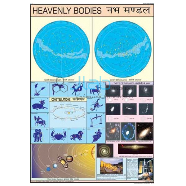
Heavenly Bodies Chart (code EL-COG-3106) is a 70 x 100 cm wall chart on the heavenly, or celestial, bodies — the stars, planets, moons and smaller objects that lie beyond the Earth’s atmosphere — for geography and science classrooms. It comes in an English-only version or a laminated version with English and Hindi combined. JLab (Jain Laboratory Instruments Pvt Ltd, Ambala, India) supplies it to schools, colleges and dealers.
Specifications
| Parameter | Detail |
|---|---|
| Subject | Heavenly (celestial) bodies — a title in the Charts on Geography range |
| Size | 70 x 100 cm |
| Versions | English only; or English and Hindi combined, laminated |
| Chart content | The panels are not itemised in the listing; ask JLab for a preview image |
| Quality check | Each chart is visually inspected before dispatch |
| Pack quantity | Each (sold individually) |
| Minimum order quantity | 10 units |
| Dispatch time | Usually 7–10 working days |
| Product code | EL-COG-3106 |
| Supplied by | Jain Laboratory Instruments Pvt Ltd (JLab), Ambala, India |
What Is the Heavenly Bodies Chart Used For?
Heavenly bodies is usually the first topic when pupils begin to study the Earth as one member of the solar system. The lesson sorts what can be seen in the sky: stars, the Sun among them, give out their own heat and light, while planets and their moons shine only because they reflect sunlight, and asteroids, comets and meteoroids make up the smaller members. A wall chart gives the class one shared reference that the teacher can come back to as the unit moves on to the Earth’s motions, the seasons and eclipses.
The laminated English and Hindi version suits Hindi-medium and dual-language schools, and the English-only version suits English-medium classes. Because the listing does not describe the illustrations, check a preview image if the chart has to follow a particular textbook. Keep the chart rolled rather than folded, and wipe a laminated chart with a soft, damp cloth.
What to Specify When Ordering
- Version — English only, or laminated English and Hindi combined; ask about the finish of the English-only chart if it matters to you.
- Quantity — the minimum order is 10 units; say how many of each version you need.
- Companion titles — the solar system, moon phase and eclipse charts, or a planetarium model, can go on the same enquiry.
- Delivery — destination country and city or port, delivery terms (for example FOB or CIF) and any tender reference.
Frequently Asked Questions
What size is the Heavenly Bodies Chart?
It measures 70 x 100 cm, a large format for a classroom or geography room wall.
Which language versions are available?
Two: an English-only chart, and a laminated chart with English and Hindi combined on the same sheet.
Is the English-only version laminated?
The listing names lamination only for the English and Hindi combined version. Ask JLab to confirm the finish of the English-only chart before you order.
What exactly does the chart show?
Its subject is the heavenly bodies, but the individual panels and labels are not listed here. Ask JLab for a preview image if you need to check the content.
Who supplies this chart?
JLab, the trading name of Jain Laboratory Instruments Pvt Ltd in Ambala, Haryana, India, supplies it and quotes for it directly.
Supplier
JLab is the trading name of Jain Laboratory Instruments Pvt Ltd, a company incorporated in 2017 and based on Hargolal Road, Ambala, Haryana. Besides the laboratory equipment in its own range, JLab supplies printed teaching charts such as this geography series, so a school can order its geography room charts together with its science apparatus. Each chart is visually inspected before it is packed. JLab exports worldwide and ships to buyers in every region — for example Angola in Central Africa, Algeria in North Africa, Singapore in Southeast Asia, Lesotho in Southern Africa and Australia in Oceania. Tender buyers can find details on the JLab lab tenders page.
Astronomy Charts and Models
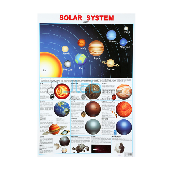
- Solar System Chart — the same size, on the Sun with its planets and moons.
- Sun and Planets Chart — a smaller laminated chart on the Sun and the planets that orbit it.
- Phases of the Moon Chart — a laminated chart on why the Moon appears to change shape.
- Solar and Lunar Eclipse Chart — how eclipses of the Sun and of the Moon happen.
- Elementary Planetarium Model For Earth Science Lab — a hand-operated Sun–Earth–Moon model for eclipses, moon phases and seasons.
See every title in Charts on Geography or the full Charts range.
Request a Quote
JLab quotes for this chart directly. Use the Add To Cart enquiry button on this page or the contact page, and give the version, the number of charts (minimum 10 units) and the delivery destination.
Last updated: 4 October 2026