Ocean Charts Manufacturer,Supplier and Exporter in India
Product Code : EL-COG-3114
Jlab Export is a leading Ocean Charts Manufacturer,and suppliers in India
Ocean Charts (code EL-COG-3114) is a 70 x 100 cm geography wall chart listing for lessons on the oceans — the world’s major oceans, the relief of the ocean floor and the movements of sea water — in school geography rooms and physical geography classes. The listing offers an English-only version and a laminated version with English and Hindi combined. JLab (Jain Laboratory Instruments Pvt Ltd, Ambala, India) supplies it to schools, colleges and dealers.
Specifications
| Parameter | Detail |
|---|---|
| Subject | The oceans (Charts on Geography range) |
| Size | 70 x 100 cm |
| Versions listed | English only; or English and Hindi combined, laminated |
| Content | Not itemised in the listing; ask for a preview image of the edition you order |
| Quality check | Each chart is visually inspected before dispatch |
| Pack quantity | Each (sold individually) |
| Minimum order quantity | 10 units |
| Dispatch time | Usually 7–10 working days |
| Product code | EL-COG-3114 |
| Supplied by | Jain Laboratory Instruments Pvt Ltd (JLab), Ambala, India |
What Are the Ocean Charts Used For?
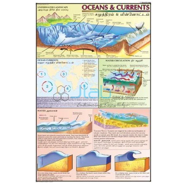
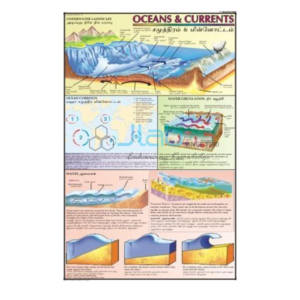
Oceans cover most of the Earth’s surface, and school geography introduces them in a few connected steps. Students first name the five oceans — the Pacific, which is the biggest and deepest, then the Atlantic, Indian, Southern and Arctic, the smallest. Next comes the relief of the ocean floor: the continental shelf and continental slope, the wide deep-sea plains, the ocean deeps or trenches and the long mid-ocean ridges. Finally the class looks at how sea water moves through waves, tides and currents, and how its temperature and salinity vary from place to place.
A wall chart lets the teacher work through each of these steps with the whole class and come back to it later in the year. Because the listing does not describe the panels, and the product photograph may not show the language edition you order, ask JLab for a preview image and confirm the language before you place an order.
What to Specify When Ordering
- Language edition — English only, or English and Hindi combined (laminated); confirm the edition against a preview.
- Single chart or set — ask JLab to confirm how many sheets the listing covers.
- Quantity — minimum 10 units.
- Further ocean titles — the ocean currents, tides, and storm and ocean current charts can be quoted together.
Frequently Asked Questions
Is Ocean Charts a single chart or a set?
The name is plural, but the listing gives one size (70 x 100 cm) and does not state a number of sheets. Ask JLab to confirm before ordering.
Which language versions can I order?
The listing offers English only, or English and Hindi combined on a laminated chart. The product photograph may show a different edition, so confirm the language with JLab.
What does the chart cover?
Its subject is the oceans; the individual panels are not described. A preview image lets you check whether it covers the topics in your syllabus, such as ocean-floor relief or currents.
Who supplies Ocean Charts?
JLab — Jain Laboratory Instruments Pvt Ltd of Ambala, Haryana, India — supplies it and quotes directly.
Supplier
JLab is the trading name of Jain Laboratory Instruments Pvt Ltd, incorporated in 2017 and based on Hargolal Road, Ambala, Haryana. Next to the laboratory and teaching equipment in its own range, JLab supplies wall charts for geography teaching, so a school or dealer can cover apparatus and charts in a single enquiry. Each chart is visually inspected before dispatch. JLab exports worldwide and ships to buyers in every region — for example Uganda in East Africa, Iraq in the Middle East, Chile in South America, Guatemala in Central America and the Caribbean and Austria in Western Europe. Tender buyers can refer to the JLab lab tenders page.
More Ocean Teaching Aids
- Ocean Currents Chart — a laminated chart on the great streams of warm and cold water in the oceans.
- Storm and Ocean Current Chart — the same size, on storms and ocean currents.
- Tides Chart — a wall chart on the rise and fall of the sea.
- Ocean Floor Raised Relief Map — a raised relief map of the land and the ocean floor for sea-bed relief and plate tectonics.
- Water Cycle In Nature Chart — how water keeps moving between the sea, the air and the land.
Browse Charts on Geography or all Charts.
Request a Quote
Use the Add To Cart enquiry button or the contact page to ask JLab for a quotation, stating the language edition, the quantity (minimum 10 units) and the delivery destination.
Last updated: 4 October 2026