Ocean Currents Chart Manufacturer,Supplier and Exporter in India
Product Code : EL-COG-3138
Jlab Export is a leading Ocean Currents Chart Manufacturer,and suppliers in India
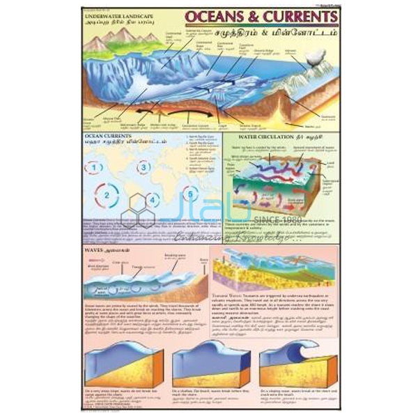
Ocean Currents Chart (code EL-COG-3138) is a laminated 50 x 75 cm geography wall chart on ocean currents — the great streams of warm and cold water that move through the seas — for school geography rooms and senior-secondary physical geography teaching. The listing gives it as bilingual, with English and Hindi combined. JLab (Jain Laboratory Instruments Pvt Ltd, Ambala, India) supplies it to schools, colleges and dealers.
Specifications
| Parameter | Detail |
|---|---|
| Topic | Ocean currents |
| Size | 50 x 75 cm |
| Finish | Laminated |
| Language | English and Hindi combined (confirm the edition in your enquiry) |
| Currents shown | Not itemised in the listing; a preview image can be requested |
| Quality check | Each chart is visually inspected before dispatch |
| Pack quantity | Each (sold individually) |
| Minimum order quantity | 10 units |
| Dispatch time | Usually 7–10 working days |
| Product code | EL-COG-3138 |
| Supplied by | Jain Laboratory Instruments Pvt Ltd (JLab), Ambala, India |
How Does It Compare with Other JLab Ocean Charts?
| Chart | Size | Versions (as listed) | Topic |
|---|---|---|---|
| This chart (EL-COG-3138) | 50 x 75 cm | Laminated; English and Hindi combined | Ocean currents |
| Storm and Ocean Current Chart | 70 x 100 cm | English only, or laminated with English and Hindi combined | Tropical storms and ocean currents on one sheet |
| Ocean Charts | 70 x 100 cm | English only, or laminated with English and Hindi combined | The major oceans, the ocean floor and the movements of sea water |
Choose this chart when you want ocean currents on their own, in the smaller laminated bilingual format that matches the other 50 x 75 cm geography titles. The larger storm and ocean current sheet suits classes that study storms alongside currents, while Ocean Charts covers the oceans more broadly.
What Is the Ocean Currents Chart Used For?
An ocean current is a steady flow of sea water in a definite direction. Surface currents are pushed mainly by the prevailing winds and turned by the Earth’s rotation — to the right in the Northern Hemisphere and to the left in the Southern — so they form huge loops, or gyres, that circle clockwise north of the equator and anticlockwise south of it. Deeper water moves too, driven by differences in temperature and salinity. Warm currents such as the Gulf Stream and the Kuroshio carry heat away from the tropics; cold currents such as the Labrador, the Humboldt (or Peru) and the Benguela flow towards the equator. In the northern Indian Ocean the currents change direction with the monsoon seasons.
The effects make the topic memorable: the warm North Atlantic Drift keeps the ports of north-western Europe free of ice, cold currents run beside the Atacama and Namib deserts, and where the Gulf Stream meets the Labrador Current off Newfoundland the mixing brings fog and some of the richest fishing grounds on Earth. The subject appears in middle-school chapters on water and in the class 11 physical geography chapter on the movements of ocean water. The currents named on the chart are not listed in the catalogue entry, and the photograph on this page may not show the language edition supplied, so ask for a preview image and confirm the language before ordering.
What to Specify When Ordering
- Quantity — a minimum of 10 charts.
- Language edition and preview — confirm English and Hindi combined and ask for an image of the chart.
- Chart size — this 50 x 75 cm chart, or one of the larger ocean titles compared above.
- Delivery — destination city and country, FOB or CIF terms for export, and any tender reference.
Frequently Asked Questions
What causes ocean currents?
Mainly winds and differences in water density. Prevailing winds drag the surface water along, the Earth’s rotation deflects it, and differences in temperature and salinity drive slower currents in the deep ocean.
What is the difference between warm and cold currents?
Their origin and effect. Warm currents flow from the equator towards the poles and warm the coasts they pass; cold currents flow from polar waters towards the equator and cool and dry the nearby land.
Why are rich fishing grounds found where warm and cold currents meet?
The mixing of the two waters favours the growth of plankton, which feeds large fish populations. The Grand Banks off Newfoundland is the classic example.
How is this chart different from the Storm and Ocean Current Chart?
This one is 50 x 75 cm, laminated and bilingual, and covers ocean currents only. The other is listed at 70 x 100 cm, in English-only or laminated bilingual versions, and combines storms with currents.
Which language edition will I receive?
The listing gives English and Hindi combined. The product photograph may show a different edition, so state the language you need and JLab will confirm it with the quotation.
Who supplies this chart?
JLab, the trading name of Jain Laboratory Instruments Pvt Ltd in Ambala, Haryana, supplies it and sends quotations directly.
Supplier
JLab is the trading name of Jain Laboratory Instruments Pvt Ltd, a school laboratory equipment and teaching-aid business incorporated in 2017 and based on Hargolal Road, Ambala, Haryana. Besides the items in its own range, JLab resells printed geography charts such as this one, so schools and dealers can bring charts, models and lab equipment together on one order; each chart is inspected visually before dispatch. JLab exports worldwide and ships to buyers in every region — Eswatini in Southern Africa, Slovenia in Southern Europe, Mexico in North America, Kyrgyzstan in Central Asia and Uganda in East Africa are a few examples. Tender buyers can consult the JLab lab tenders page.
Ocean and Climate Teaching Aids
- Storm and Ocean Current Chart — storms and currents together on a larger sheet.
- Ocean Charts — the major oceans, the sea floor and the movements of sea water.
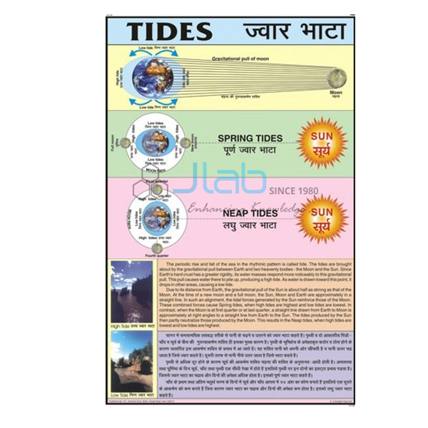
- Tides Chart — a laminated 50 x 75 cm chart on the rise and fall of the sea.
- Factors that Affect Climate Chart — where ocean currents fit among the controls of climate.
- Pressure and Winds Chart — the winds that drive surface currents.
- Ocean Floor Raised Relief Map — a raised relief map of the world showing the land and the ocean floor.
Browse more Charts on Geography or the full Charts range.
Request a Quote
Quotations come directly from JLab. Use the Add To Cart button on this page or the contact page, and send the quantity (minimum 10 units), the language edition, any companion charts and the delivery destination.
Last updated: 4 October 2026