Physical Features of Earth Chart Manufacturer,Supplier and Exporter in India
Product Code : EL-COG-3129
Jlab Export is a leading Physical Features of Earth Chart Manufacturer,and suppliers in India
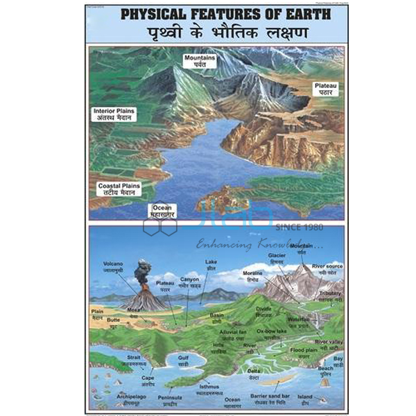
Physical Features of Earth Chart (code EL-COG-3129) is a 50 x 75 cm laminated wall chart for geography lessons on the physical features of the Earth’s surface, the kinds of landform and water body that pupils learn to recognise and name in middle school. Its text is in English and Hindi combined. JLab (Jain Laboratory Instruments Pvt Ltd, Ambala, India) supplies it to schools, colleges and dealers.
Specifications
| Parameter | Detail |
|---|---|
| Subject | Physical features of the Earth |
| Size | 50 x 75 cm |
| Finish | Laminated |
| Language | English and Hindi combined |
| Features shown | Not itemised in the listing; ask JLab for a preview image |
| Quality check | Each chart is visually inspected before dispatch |
| Pack quantity | Each (sold individually) |
| Minimum order quantity | 10 units |
| Dispatch time | Usually 7–10 working days |
| Product code | EL-COG-3129 |
| Supplied by | Jain Laboratory Instruments Pvt Ltd (JLab), Ambala, India |
What Is the Physical Features Chart Used For?
The surface of the Earth is usually taught through three major landforms — mountains, plateaus and plains — together with the oceans, seas, lakes and rivers around them; in NCERT geography this is the class 6 chapter on the major landforms of the Earth. A wall chart lets the class compare the features side by side and talk about why people live where they do: flat, fertile plains carry most of the world’s farms and towns, while mountains and plateaus are often rich in forests and minerals.
In class 7 the same picture is used to explain how the surface keeps changing. Forces inside the Earth, such as earthquakes and volcanoes, raise or break the crust, while weathering and erosion by running water, wind, glaciers and sea waves wear the land down and deposit the material elsewhere. The chart’s exact panels are not listed, so request a preview if you need to check them against your textbook.
What to Specify When Ordering
- Quantity — at least 10 charts, sold individually.
- Preview — ask for an image of the chart before ordering for a specific syllabus.
- Landform series — the volcano, earthquake, glacial and coastal charts linked below cover the forces that shape these features.
Frequently Asked Questions
What size and finish is the Physical Features of Earth Chart?
It is 50 x 75 cm and laminated.
Which languages does it use?
English and Hindi, printed together on the same chart.
What are the three major landforms?
Mountains, plateaus and plains. Mountains rise steeply well above the surrounding land, plateaus are raised areas with a fairly flat top, and plains are broad stretches of low, flat land.
Which forces change the Earth’s physical features?
Internal forces, such as earthquakes and volcanic activity, lift or break the crust; external forces, mainly erosion and deposition by rivers, wind, glaciers and the sea, wear the land down and build new features.
Who supplies this chart?
JLab, the trading name of Jain Laboratory Instruments Pvt Ltd in Ambala, Haryana, India, supplies the chart and quotes for it directly.
Supplier
JLab is the trading name of Jain Laboratory Instruments Pvt Ltd, incorporated in 2017 and located on Hargolal Road, Ambala, Haryana. The company supplies geography wall charts such as this one together with the laboratory and teaching equipment of its own range, so schools, colleges and dealers can fit out a geography room through one supplier; charts are visually checked before they leave Ambala. JLab exports worldwide and has buyers in every region — Tonga in Oceania, Madagascar in East Africa, Algeria in North Africa, Iraq in the Middle East and Lithuania in Northern Europe are a few examples. See the JLab lab tenders page for tender buying.
Charts on the Forces That Shape Landforms
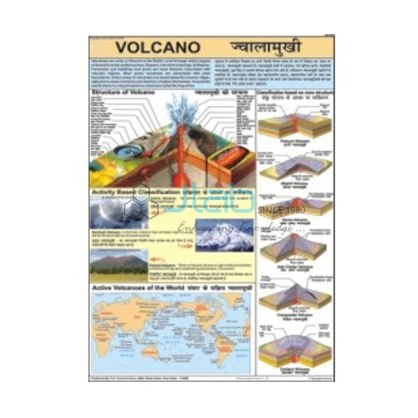
- Volcano Chart — how molten rock reaches the surface and builds landforms around a vent.
- Earthquake Chart — why the ground shakes and how the shaking spreads.
- Glacial Landform Chart — landforms made by glaciers through erosion, transportation and deposition.
- Coastal Landscape Chart — how waves wear away and build up shorelines.
- Hill Features, Contours and Map Setting Chart — how relief is drawn on maps with contour lines.
- Ocean Floor Raised Relief Map — the relief of both the land and the ocean floor.
See every title in Charts on Geography or the wider Charts range.
Request a Quote
JLab quotes directly. Use the Add To Cart enquiry button or the contact page and give the quantity (minimum 10 units), your delivery location and any other charts from the landform series you need.
Last updated: 4 October 2026