June Map Manufacturer,Supplier and Exporter in India

Product Code : EL-WMOI-3166
Jlab Export is a leading June Map Manufacturer,and suppliers in India
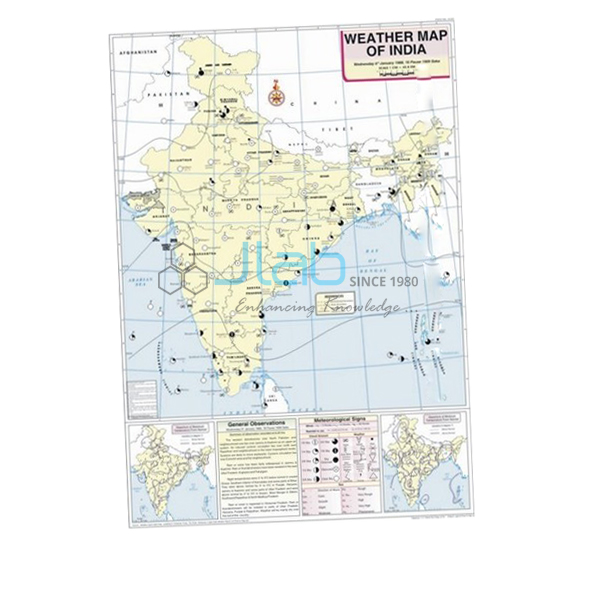
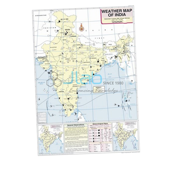
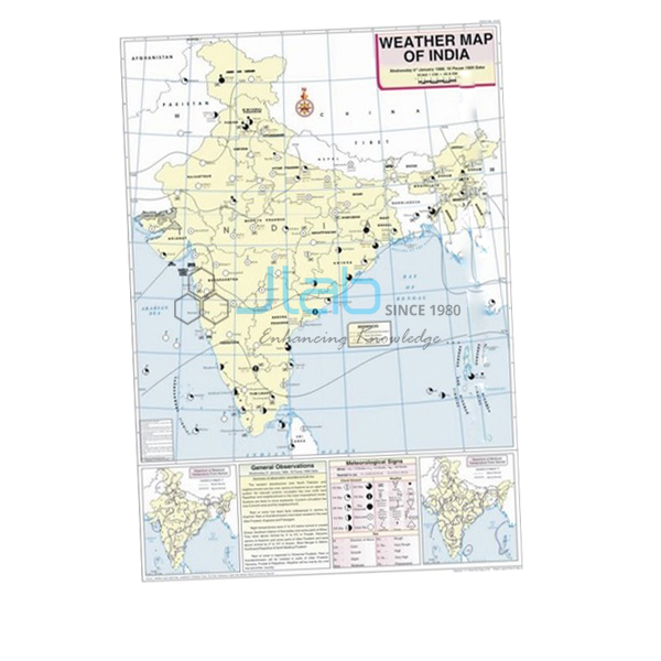
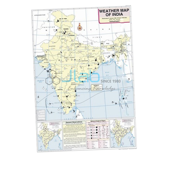
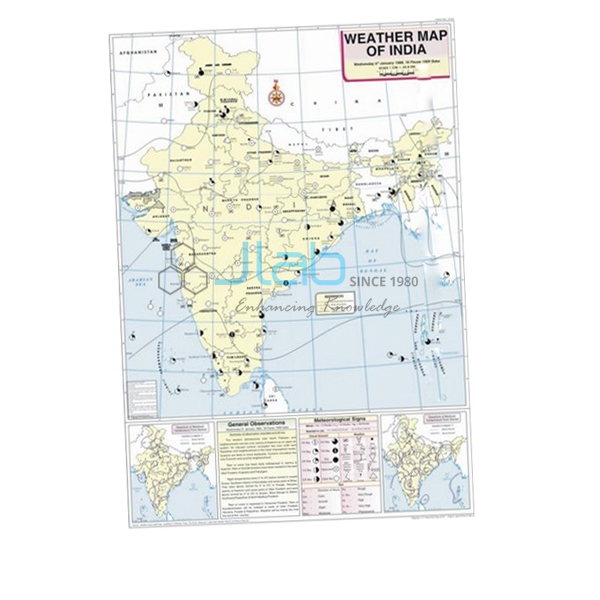
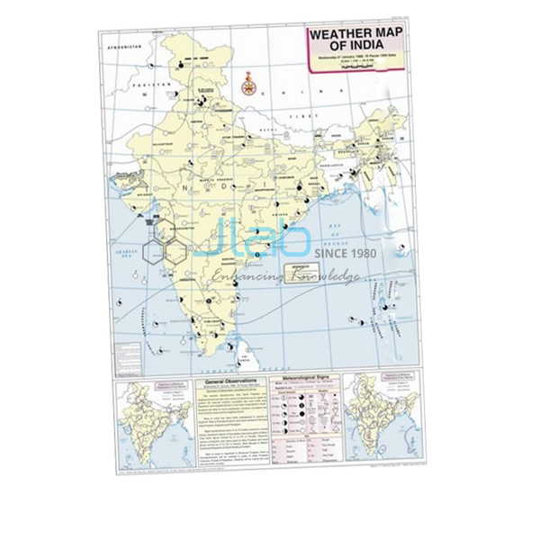
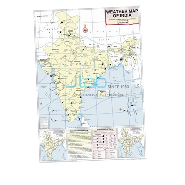
June Map (code EL-WMOI-3166) is a weather map of India for June, used in geography practicals to teach students how to interpret and record the weather of a day. Printed in colour on white synthetic polyart sheet with plastic rollers, the 70 x 100 cm map shows the important meteorological stations, maximum and minimum temperatures, isobars and meteorological signs, with English text. It is made by Jain Laboratory Instruments Pvt Ltd (JLab) at its works in Ambala, India.
Specifications
| Parameter | Detail |
|---|---|
| Map | Weather map of India — June |
| Map content | Locations of important meteorological stations in the country; weather conditions of the day and how to record and depict them; maximum and minimum temperature; isobars and meteorological signs |
| Printing | Multicolour on white synthetic polyart sheet |
| Rollers | Plastic rollers fitted |
| Size | 70 x 100 cm |
| Language | English |
| Quality check | Each map is visually inspected before dispatch |
| Pack quantity | Each (sold individually) |
| Minimum order quantity | 10 units |
| Dispatch time | Usually 7–10 working days |
| Product code | EL-WMOI-3166 |
| Manufacturer | Jain Laboratory Instruments Pvt Ltd (JLab) — OEM |
| Country of origin | India (made in Ambala, Haryana) |
What Is the June Weather Map Used For?
June opens the south-west monsoon season. The monsoon normally sets in over Kerala at the start of the month, often with a sudden spell of heavy rain and thunder known as the burst of the monsoon, and then advances north in two branches: the Arabian Sea branch along the west coast and the Bay of Bengal branch towards the north-east, from where it turns west along the Ganga plain. Temperatures drop wherever the rain arrives, while the north-west can stay hot until the monsoon reaches it. This makes a June map a good one for discussing why the same day can be wet in one part of India and scorching in another.
Students read the maximum and minimum temperature of each marked station, follow the isobars to find where pressure is lowest and highest, and write out what the meteorological signs say about cloud, wind and rain. The map’s own explanation of how the day’s weather is recorded and depicted gives them the format for the weather maps exercise in class 11 geography practicals and for college climatology work.
What to Specify When Ordering
- June maps — the number required, with a minimum order of 10 units.
- Monsoon sequence — the May and July maps show conditions before and after; each has its own listing.
- Rainfall measurement — a rain gauge so students can record monsoon rainfall at school.
- Delivery — destination, delivery terms and any tender reference.
Frequently Asked Questions
What does the June Map display?
Important meteorological stations across India, their maximum and minimum temperatures, isobars and meteorological signs, together with an explanation of how the day’s weather is recorded and depicted.
Does the map show a particular date?
The listing describes the weather conditions of a day without stating the date. Ask JLab when you enquire if you need to know which day is mapped.
What is the “burst” of the monsoon?
The sudden start of heavy monsoon rain, often with thunder and strong winds, after the hot, dry weeks before the monsoon reaches a place.
How is the map made for classroom use?
It is printed on white synthetic polyart sheet in multiple colours and fitted with plastic rollers, so it hangs flat for lessons and rolls up for storage. Size: 70 x 100 cm.
Who manufactures the June Map?
Jain Laboratory Instruments Pvt Ltd, known as JLab, at its works in Ambala, Haryana, India.
OEM Manufacturer
JLab is how Jain Laboratory Instruments Pvt Ltd trades: a manufacturer of educational maps, charts and laboratory equipment in India, incorporated in 2017 and based on Hargolal Road, Ambala, Haryana. JLab makes the June map in its own works, so there is no trader in between — schools, colleges, dealers and importers buy from the source, every map is visually inspected before it is packed, and repeat orders come back to the same works. JLab exports worldwide and ships to all regions, for example Algeria in North Africa, the USA in North America, Greece in Southern Europe, Poland in Eastern Europe and Bolivia in South America. Tender information is on the JLab lab tenders page.
Monsoon Maps and Weather Instruments
- May Map — the hottest weeks before the monsoon arrives.
- July Map — the month the monsoon normally covers the whole country.
- Rain Gauge — for comparing rainfall between seasons at your own school.
- Aneroid Barometer — measures the atmospheric pressure shown by isobars.
- Weather Map Symbols Chart — the key to the signs on the map.
See all titles in Weather Maps of India or the wider Charts range.
Request a Quote
Quotes come direct from the manufacturer. Use the Add To Cart button on this page, or send the months, the quantity of each (minimum 10 units) and your delivery location through the contact page.
Last updated: 4 October 2026