December Map Manufacturer,Supplier and Exporter in India
Product Code : EL-WMOI-3172
Jlab Export is a leading December Map Manufacturer,and suppliers in India
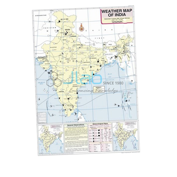
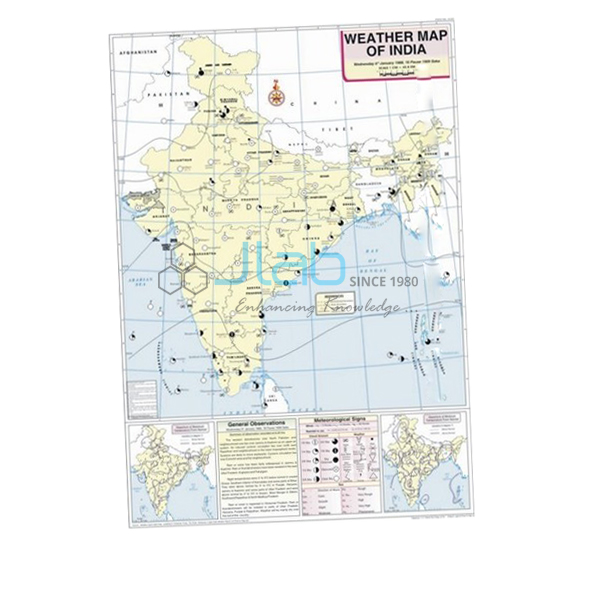
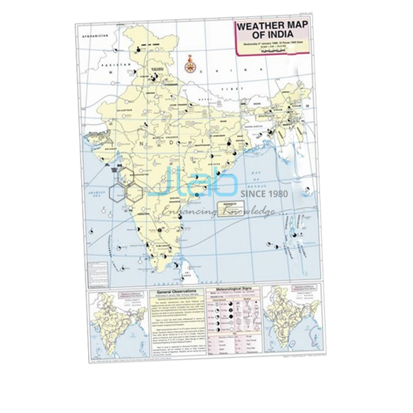
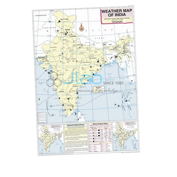
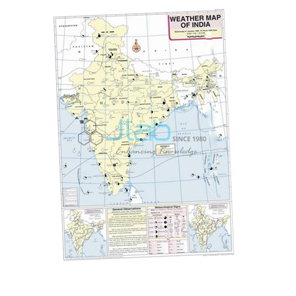
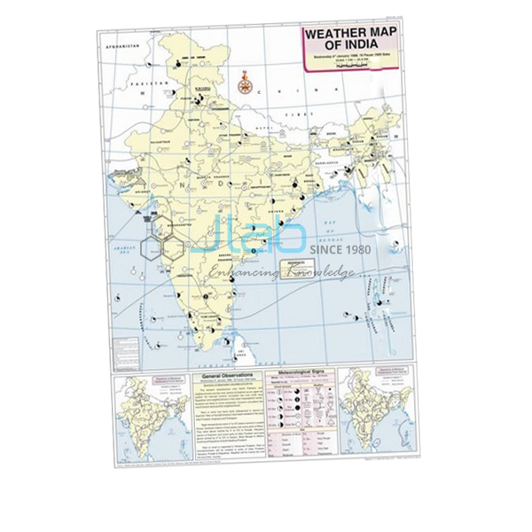
December Map (code EL-WMOI-3172) is an English-language weather map of India for December, 70 x 100 cm, for geography lab lessons on interpreting a weather map and recording the day’s weather. It gives the locations of important meteorological stations, maximum and minimum temperatures, isobars and meteorological signs, printed in multicolour on white synthetic polyart sheet with plastic rollers. Jain Laboratory Instruments Pvt Ltd (JLab) makes it at its works in Ambala, India.
Specifications
| Parameter | Detail |
|---|---|
| Map | Weather map of India for December |
| Features on the map | Locations of important meteorological stations in the country; weather conditions of the day and how to record and depict them; maximum and minimum temperature; isobars and meteorological signs |
| Printing and base | Multicolour, on white synthetic polyart sheet |
| Rollers | Plastic rollers |
| Size | 70 x 100 cm |
| Language | English |
| Quality check | Each map is visually inspected before dispatch |
| Pack quantity | Each (sold individually) |
| Minimum order quantity | 10 units |
| Dispatch time | Usually 7–10 working days |
| Product code | EL-WMOI-3172 |
| Manufacturer | Jain Laboratory Instruments Pvt Ltd (JLab) — OEM |
| Country of origin | India (made in Ambala, Haryana) |
What Is the December Weather Map Used For?
December lies in India’s cold weather season, and with January it is one of the two coldest months in the north. Temperatures fall from south to north, high pressure settles over north-west India, and the light north-east winds that blow out from the land keep most of the country dry; days are often pleasant while nights turn cold, and fog and cold waves can grip the northern plains. Two exceptions make good discussion points: western disturbances from the Mediterranean bring winter rain to the north-western plains and snow to the Himalayas, which helps the rabi crop, and the Tamil Nadu coast still receives north-east monsoon rain.
The December map lets students find these features themselves in a geography lab session. They can read the stations from south to north and see how the minimum temperatures change, use the isobars to place the area of high pressure, and use the meteorological signs to spot any rain or fog. The map also explains how a day’s weather is recorded and depicted, which matches the weather-map work in the class 11 geography practical and is a good revision sheet for the climate chapter in class 9. Store the map rolled on its rollers when it is not hanging.
What to Specify When Ordering
- Months — December alone, or the December and January maps together for a complete winter lesson; November adds the lead-in from the post-monsoon season.
- Quantity — the minimum order is 10 units.
- Language — English is the listed language.
- Instruments — a wet-and-dry hygrometer or a barometer if students will record humidity or pressure on winter mornings.
Frequently Asked Questions
What does the December Map contain?
The locations of important meteorological stations, maximum and minimum temperatures, isobars and meteorological signs, together with the weather conditions of the day and how to record and depict them.
What are western disturbances?
Low-pressure systems that originate over the Mediterranean region and travel east in winter. They bring rain to the plains of north-west India and snow to the Himalayas, which benefits rabi crops such as wheat.
Why is fog common in northern India in December?
On long, clear winter nights the ground loses heat quickly, and the air close to it can cool to its dew point. The moisture then condenses into fog, which often persists into the morning over the northern plains.
How large is the map and what is it printed on?
The map is 70 x 100 cm, printed in multicolour on white synthetic polyart sheet, and fitted with plastic rollers.
Is the January map included?
No. Each month is sold as its own listing, so order the January map separately if you want the full winter pair.
How do I get an export quotation?
Send the quantity, the destination country and port or city, the delivery terms you want (FOB or CIF, for example), any packing or labelling requirements, and a tender reference if applicable.
Who manufactures the December Map?
JLab, trading name of Jain Laboratory Instruments Pvt Ltd, manufactures it at its works in Ambala, Haryana, India.
OEM Manufacturer
Behind the December map is JLab, the trading name of Jain Laboratory Instruments Pvt Ltd, a manufacturer of geography lab equipment, maps and charts in India, incorporated in 2017 and working from Hargolal Road, Ambala, Haryana. The map is produced in JLab’s own works and is not resold from a trader, so schools, colleges, dealers and importers are supplied directly by the maker, every map is visually checked before dispatch, and repeat orders are met by the same manufacturer. JLab is registered as a manufacturing enterprise under MSME Udyam registration UDYAM-HR-01-0003849 and exports under Importer-Exporter Code 3317504552. It exports worldwide and ships to buyers in every region — Latvia in Northern Europe, Tajikistan in Central Asia, New Zealand in Oceania, Madagascar in East Africa and Mexico in North America, for example. Tender information is on the JLab lab tenders page.
Winter Maps and Related Weather Aids
- November Map — the month before, in the same 70 x 100 cm series.
- January Map — the weather map for the next month, to complete the winter pair.
- Hygrometer Wet and Dry — two thermometers, one wet-bulb and one dry-bulb, for measuring humidity.
- Aneroid Barometer — for measuring atmospheric pressure in the lab.
- Weather Map Symbols Chart — a wall chart that teaches the symbols used on weather maps.
Find every month in Weather Maps of India, or go to the main Charts category.
Request a Quote
Quotations for the December map come from JLab as the manufacturer. Click Add To Cart on this page, or use the contact page to tell us how many maps you need (minimum 10 units), whether to add January or other months and instruments, and where the goods should be delivered.
Last updated: 4 October 2026