February Map Manufacturer,Supplier and Exporter in India
Product Code : EL-WMOI-3161
Jlab Export is a leading February Map Manufacturer,and suppliers in India
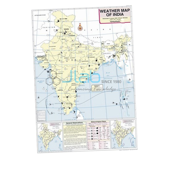
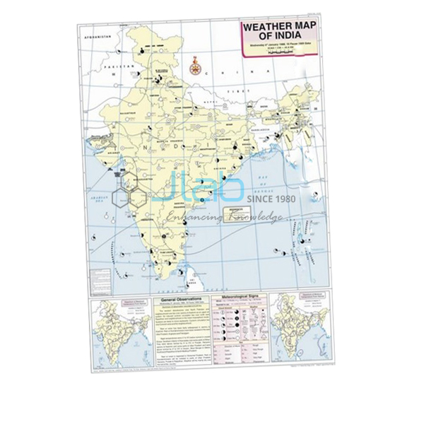
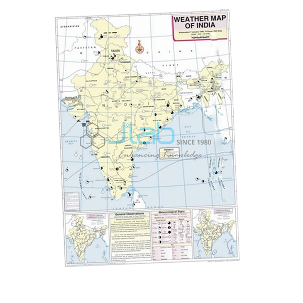
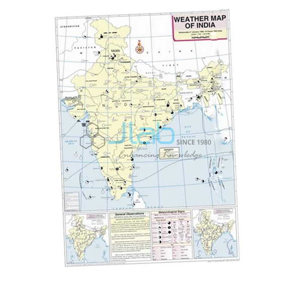
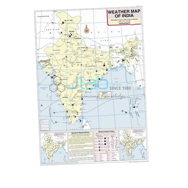
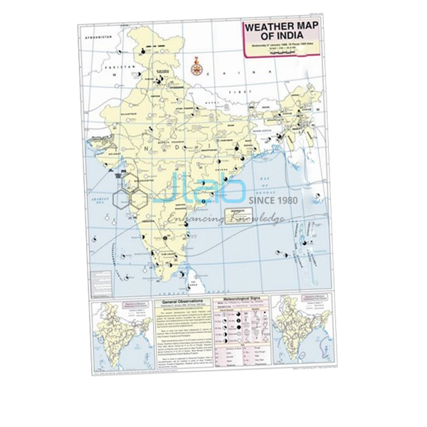
February Map (code EL-WMOI-3161) is a 70 x 100 cm weather map of India for February, used in school and college geography practicals to teach how one day’s weather is observed, recorded and plotted. It marks the important meteorological stations with their maximum and minimum temperatures, isobars and meteorological signs, printed in several colours on white synthetic polyart sheet with plastic rollers. It is made by Jain Laboratory Instruments Pvt Ltd (JLab) at its works in Ambala, India.
Specifications
| Parameter | Detail |
|---|---|
| Map | Weather map of India — February |
| Shows | Locations of important meteorological stations in the country; weather conditions of the day and how to record and depict them; maximum and minimum temperature; isobars and meteorological signs |
| Printing | Multicolour print on white synthetic polyart sheet |
| Rollers | Plastic rollers |
| Size | 70 x 100 cm |
| Language | English |
| Quality check | Each map is visually inspected before dispatch |
| Pack quantity | Each (sold individually) |
| Minimum order quantity | 10 units |
| Dispatch time | Usually 7–10 working days |
| Product code | EL-WMOI-3161 |
| Manufacturer | Jain Laboratory Instruments Pvt Ltd (JLab) — OEM |
| Country of origin | India (made in Ambala, Haryana) |
What Is the February Weather Map Used For?
With the February map students practise the core skills of weather-map reading: finding the important meteorological stations, reading the maximum and minimum temperature at each, following the isobars to pick out areas of high and low pressure, and translating the meteorological signs into words. The map also explains how the day’s weather is recorded and depicted, which gives students a model for their own practical files in the weather maps and charts work of class 11 geography and in college climatology practicals.
In the India Meteorological Department’s seasons, February closes the winter. Temperatures begin to climb, first in the south, but western disturbances can still bring rain, hail and Himalayan snow to the north-west — welcome moisture for wheat and mustard, though hail can flatten standing crops. Hung between the January and March maps, it lets a class watch the cold season loosen its hold.
What to Specify When Ordering
- Months required — each monthly weather map has its own listing, so name every month you want.
- Quantity — at least 10 units of this map; give a separate figure for each other month.
- Decoding aids — the weather map symbols and weather instruments charts, if your geography room does not have them yet.
Frequently Asked Questions
What can students read from the February Map?
The positions of India’s important meteorological stations, the maximum and minimum temperature at each, the isobars and the meteorological signs, together with guidance on how a day’s weather is recorded and drawn.
Is February still winter in India?
Yes, in the India Meteorological Department’s classification winter covers January and February. Temperatures rise through the month, but the north-west can still see cold spells and rain or snow from western disturbances.
What is the map printed on?
White synthetic polyart sheet, printed in multiple colours and fitted with plastic rollers so it can hang in class and roll up for storage. It measures 70 x 100 cm.
Is the map available in Hindi?
The listing states English only. If your course needs another language, ask JLab before ordering rather than assuming a translated edition exists.
Who manufactures the February Map?
Jain Laboratory Instruments Pvt Ltd (JLab) makes it at its works in Ambala, Haryana, India.
OEM Manufacturer
JLab is the trading name of Jain Laboratory Instruments Pvt Ltd, an Indian maker of geography maps, teaching charts and laboratory equipment, incorporated in 2017 with its works on Hargolal Road, Ambala, Haryana. The February map comes from those works rather than from a reseller, so schools, colleges, dealers and importers buy direct, every map gets a visual check before it is packed, and reorders are handled by the same manufacturer. JLab’s export reach covers every region of the world — for example Hong Kong in East Asia, Thailand in Southeast Asia, Turkmenistan in Central Asia, Iceland in Northern Europe and Gabon in Central Africa. Buyers preparing a tender can start from the JLab lab tenders page.
Neighbouring Months and Weather Teaching Aids
- January Map — the month before, for comparing the depth of winter with its close.
- March Map — the month after, when the hot weather season begins.
- Weather Map Symbols Chart — the key students need to decode the signs on the map.
- Weather Instruments Chart — the instruments behind the readings plotted on a weather map.
- Thermometer Maximum Minimum Indoor or Outdoor — for recording the school’s own daily maximum and minimum.
See every month in Weather Maps of India or browse all Charts.
Request a Quote
Quotes come direct from the manufacturer. Press Add To Cart on this page, or send the months and quantities you need (minimum 10 units per listing) and your delivery location through the contact page.
Last updated: 4 October 2026