Sea Water Map Manufacturer,Supplier and Exporter in India
Product Code : EL-CFOTE-3144
Jlab Export is a leading Sea Water Map Manufacturer,and suppliers in India
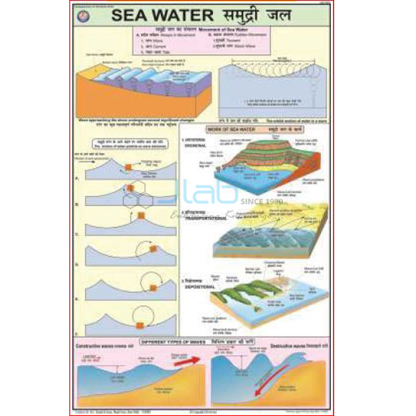
Sea Water Map (code EL-CFOTE-3144) is a laminated 50 x 75 cm geography wall chart on the work of the sea: erosion, the transportation of particles and the deposition of the eroded material. It is printed in multicolour on 80 gsm map litho paper, carries English and Hindi text together and hangs from plastic rollers. JLab (Jain Laboratory Instruments Pvt Ltd, Ambala, India) supplies it to schools, colleges and dealers.
Specifications
| Parameter | Detail |
|---|---|
| Topic | Erosion, transportation of the particles and deposition of the eroded material by sea water |
| Size | 50 x 75 cm |
| Printing | Multicolour on 80 gsm map litho paper |
| Lamination | Hot-seal polyester film on both sides |
| Hanging | Plastic rollers at top and bottom |
| Language | English and Hindi combined |
| Quality check | Each chart is visually inspected before dispatch |
| Pack quantity | Each (sold individually) |
| Minimum order quantity | 10 units |
| Dispatch time | Usually 7–10 working days |
| Product code | EL-CFOTE-3144 |
| Supplied by | Jain Laboratory Instruments Pvt Ltd (JLab), Ambala, India |
What Is the Sea Water Map Used For?
The chart supports geography lessons on how the sea shapes a coastline. Waves wear rock away by hydraulic action, abrasion, attrition and solution, cutting cliffs, caves, arches and stacks; waves and currents then carry sand and shingle along the shore, and where the water loses energy the material is dropped to build beaches, spits and bars. Teachers use it for the work of sea waves in middle-school geography, such as the class 7 NCERT chapter Our Changing Earth, and for coastal landforms in class 11 physical geography, as well as in college geography labs and teacher-training rooms.
Hang the chart from its top roller at eye level so a whole class can follow the sequence from erosion to deposition. The polyester lamination lets you wipe it with a damp cloth, and rolling it from the bottom roller for storage keeps the sheet flat and free of creases between terms.
What to Specify When Ordering
- Quantity — the minimum order is 10 charts; schools often order one per geography room plus a set for the library.
- Language — this listing is the English and Hindi combined edition; ask before ordering if you need another language.
- Companion charts — add the river, glacier, wind and ground water charts from the same range to the enquiry if you are equipping a geography lab.
- Delivery details — destination, delivery terms and any packing or labelling instructions, so the quotation covers everything.
Frequently Asked Questions
What does the Sea Water Map show?
Its subject is the work of sea water: erosion, the transportation of the particles and the deposition of the eroded material. The listing does not itemise each diagram, so ask JLab for a current image if you need to check the layout before ordering.
Is it a map of the world’s seas and currents?
The listing describes it as a chart of erosion, transportation and deposition by sea water and does not mention named seas or ocean currents. For the circulation of warm and cold water through the oceans, see the Ocean Currents Chart linked below.
What size is the chart and how is it finished?
It measures 50 x 75 cm, is printed in multicolour on 80 gsm map litho paper, is laminated with hot-seal polyester film on both sides and has plastic rollers fitted at the top and bottom.
Which language is it printed in?
English and Hindi appear together on the same sheet, which suits bilingual classrooms. Ask before ordering if your school needs a different language.
What should an export enquiry include?
Send the quantity, the destination country and port or city, your preferred delivery terms (for example FOB or CIF), any packing or labelling needs and the tender reference if the order is for a tender.
Who supplies the Sea Water Map?
Jain Laboratory Instruments Pvt Ltd, trading as JLab, of Ambala, Haryana, India, supplies this chart and quotes for it directly.
Supplier
JLab is the trading name of Jain Laboratory Instruments Pvt Ltd, a science and laboratory equipment company incorporated in 2017 and based on Hargolal Road, Ambala, Haryana. It supplies printed teaching charts such as this one alongside the laboratory equipment it produces, so a school or dealer can place wall charts and lab items on one order, and each chart is checked by eye before it is packed. The company is registered under CIN U29309HR2017PTC069123 and holds GSTIN 06AADCJ9848D1ZE. JLab exports worldwide and serves buyers in every region — for example Liberia in West Africa, Sweden in Northern Europe, Tajikistan in Central Asia, the Netherlands in Western Europe and Kuwait in the Middle East. Tender information is on the JLab lab tenders page.
Other Landform and Earth Process Charts
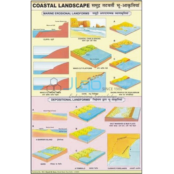
- Coastal Landscape Chart — figures and diagrams of the coastal landscape made by sea water, the natural partner to this chart.
- Ocean Currents Chart — the warm and cold currents that circulate through the oceans.
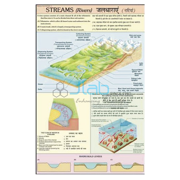
- Rivers Landscape Chart — erosion and depositional landforms created by rivers.
- Glacial Landform Chart — how glaciers form landforms by erosion, transportation and deposition.
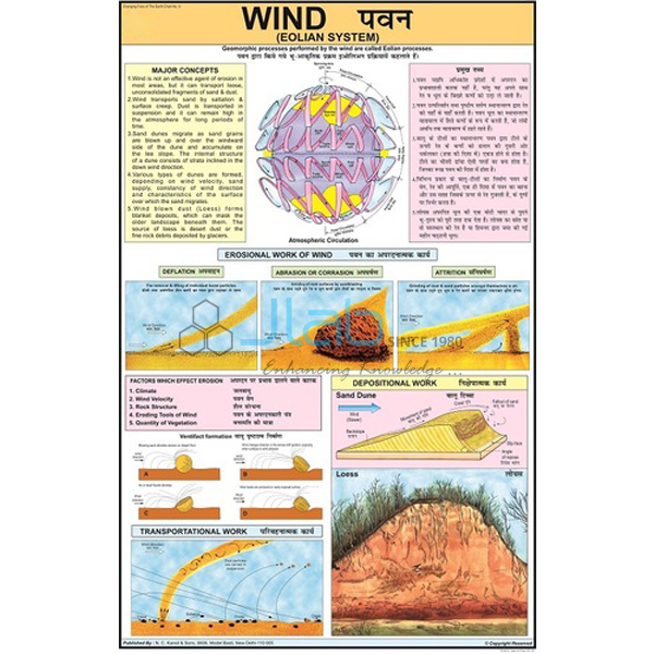
- Wind Eolian System Chart — how wind acts on the Earth’s surface.
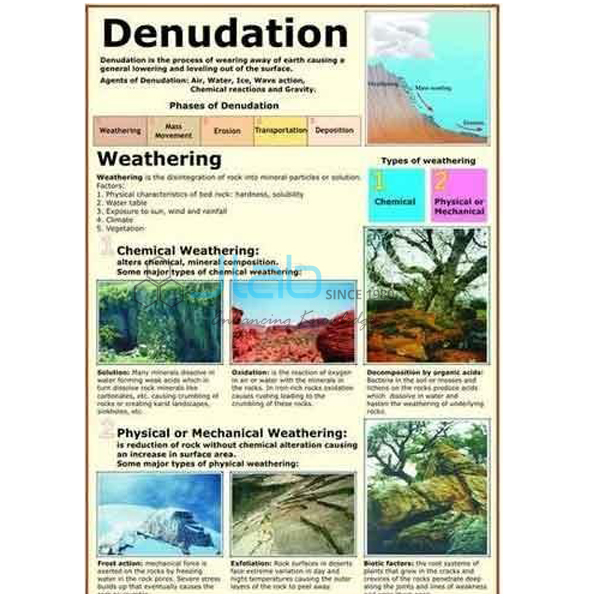
- Denudation Chart — weathering and the chemical and physical effects of erosion.
Browse the full Changing Face of the Earth range or all science charts.
Request a Quote
Quotes come directly from JLab. Use the Add To Cart enquiry button on this page, or send the quantity (minimum 10 units), any companion charts you want and your delivery location through the contact page.
Last updated: 4 October 2026