
Map Projection Chart Manufacturer,Supplier and Exporter in India
Product Code : EL-COG-3117
Jlab Export is a leading Map Projection Chart Manufacturer,and suppliers in India
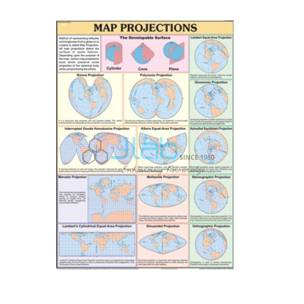
Map Projection Chart (code EL-COG-3117) is a 70 x 100 cm wall chart on map projections — the methods used to draw the curved surface of the Earth, with its lines of latitude and longitude, on a flat map — for practical geography classes in schools and colleges. It is available in English only or as a laminated English and Hindi combined chart. JLab (Jain Laboratory Instruments Pvt Ltd, Ambala, India) supplies it to schools, colleges and dealers.
Get a quote: use the Add To Cart enquiry button below, or send your quantity and destination through the contact page.
Specifications
| Parameter | Detail |
|---|---|
| Subject | Map projections (practical geography) |
| Chart size | 70 x 100 cm |
| Versions | English only; or English and Hindi combined, laminated |
| Finish of English-only version | Not stated in the listing — confirm with JLab |
| Projections illustrated | Not listed; a preview image can be requested |
| Quality check | Each chart is visually inspected before dispatch |
| Pack quantity | Each (sold individually) |
| Minimum order quantity | 10 units |
| Dispatch time | Usually 7–10 working days |
| Product code | EL-COG-3117 |
| Supplied by | Jain Laboratory Instruments Pvt Ltd (JLab), Ambala, India |
What Is the Map Projection Chart Used For?
A map projection is a systematic way of transferring the graticule — the network of latitudes and longitudes — from a globe onto a flat sheet. Because a sphere cannot be flattened without stretching or tearing, every projection distorts something, and no flat map keeps area, shape, distance and direction all correct at once. Projections are therefore grouped by the surface they are imagined on (cylindrical, conical or zenithal) and by the property they keep true (equal-area, conformal or equidistant). The Mercator projection is the usual example: it is cylindrical and conformal, so a line of constant compass bearing is straight, which helped navigators, but it enlarges land areas more and more towards the poles.
The topic is a chapter of senior-secondary practical geography — class 11 in the NCERT scheme — and returns in college practicals where students construct simple projections. Ask for a preview image if your course needs particular projections shown.
What to Specify When Ordering
- Version — English only, or laminated English and Hindi combined.
- Minimum quantity — 10 units.
- Comparison aids — a physical globe and the latitude and longitude chart help students compare the round Earth with its flat projections.
Frequently Asked Questions
Which projections does the Map Projection Chart show?
The listing does not name them. Request a preview image from JLab to see whether the projections in your syllabus are covered.
What size is it, and in what languages?
It is 70 x 100 cm, in an English-only version or a laminated chart with English and Hindi combined.
Why do maps need projections at all?
A globe is the only true model of the Earth, but it cannot be flattened without distortion. A projection is a chosen compromise that keeps some properties, such as shape or area, correct for the map’s purpose.
What is the minimum order and dispatch time?
Minimum 10 units, supplied individually. Dispatch is usually within 7–10 working days after a visual inspection; export transit is added.
Who supplies this chart?
JLab, the trading name of Jain Laboratory Instruments Pvt Ltd, Ambala, Haryana, India, supplies it and quotes for it directly.
Supplier
The JLab name belongs to Jain Laboratory Instruments Pvt Ltd, a company incorporated in 2017 and based on Hargolal Road, Ambala, Haryana. It offers practical geography charts such as this one together with the laboratory and teaching equipment of its own range, so colleges and schools can source a geography lab through one supplier, and it inspects every chart visually before dispatch. JLab exports worldwide and ships to buyers in every region — for example Armenia in Eastern Europe, North Macedonia in Southern Europe, Iraq in the Middle East, Mexico in North America and Togo in West Africa. Tender buyers can consult the JLab lab tenders page.
Globes and Map Charts
- Latitude and Longitude Chart — the imaginary grid that every projection has to transfer.
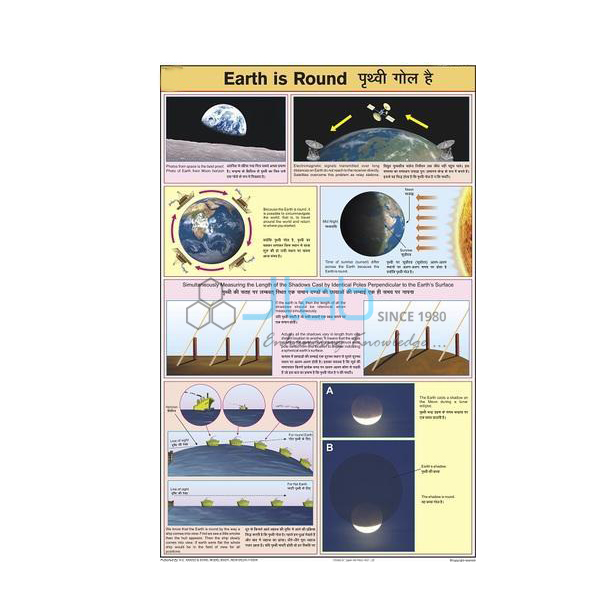
- Earth Is Round Chart — the shape of the Earth and the evidence that it is round.
- Physical Globe — the round model to set beside the flat map.
- Conventional Signs Chart — the same size, on the signs used on maps.
- Surveying Chart — the same size, on measuring the ground for map-making.
Other titles: Charts on Geography and the full Charts range.
Request a Quote
For a quotation direct from JLab, use the Add To Cart enquiry button or the contact page, with the version, the number of charts (minimum 10 units) and the delivery destination.
Last updated: 4 October 2026